by Bryan Jauregui, Todos Santos Eco Adventures. This article was originally published in Janice Kinne’s Journal del Pacifico.
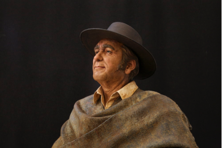
This is not a fish tale. It’s an immigrant story any American could tell. “In 1860 my great grandfather Esteban Puppo arrived in Cabo San Lucas from Genoa, Italy. He brought money and a son with him and purchased a hacienda in Caduaño, near Miraflores. He raised cattle and built a good life. His son Santiago grew up, married a beautiful woman from the coast and had my father, Pedro Puppo, in 1889. But it was a troubled time in Mexico and the government took away the hacienda, so Pedro went to La Ribera where he opened a general store. There he met and married a young shop attendant, Seferina Marrón. They moved to La Paz in 1910 where my brother Santiago was born in 1929 and I was born in 1939. My father became a fisherman, as did my brother and I. Santiago has been fishing the waters of Isla Espiritu Santo and La Paz for 80 years. My father would be sad to know that we are the last independent fishermen of Isla Espiritu Santo.”
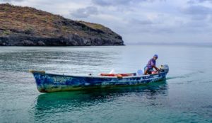
Mario Puppo Marrón, the younger of the two famed Puppo brothers, tells his family story with humor, passion and a keen understanding that his family history is the history of Isla Espiritu Santo and the fishing industry in La Paz. When his father Pedro became a fisherman in 1910, he and his colleagues would row or sail their boats – crafts that were more like canoes than pangas – to Espiritu Santo, often taking two days or more to reach their destination. That trip now takes less than an hour by motorboat. They would stay on the island for months, camping wherever they liked, salting the fish they caught to keep it from rotting. They could sell the salted fish for 1.5 pesos per kilo (4 pesos per kilo for shark) and in two months they could make 1,000 pesos. In those days the pesos were silver and living was cheap, so 1,000 pesos was a lot of money. It had to be to motivate the fishermen to endure months on the island.
Recalls Mario. “I was 10 years old when I started working with my father on Isla Espiritu Santo. There is very little fresh water on the island and the water from home was sent in cans so it rusted quickly. Therefore almost every day we would eat tortillas, fish machaca, and turtle. We would have vegetables for the first few days after arriving on the island, then nothing for the remaining weeks or months. We couldn’t make beans because there was no water to cook them. Our only “spices” were onions and chiles. It was exciting when we were able to catch one of the wild goats on the island for the pot.”
When Mario’s father Pedro started fishing in 1910, an entrepreneur and local politician named Gaston Vives had a concession in San Gabriel Bay on Espiritu Santo for cultivating pearls. It was a substantial operation that included homes, offices and a 500-meter-long dike which turned the bay into a lagoon. There he created a massive system of 36 roofed canals through which he steered the waters of the Sea of Cortez to supply the necessary nutrients and oxygen to his oyster beds. He was wildly successful, selling his cultivated pearls throughout the US and Europe. Mario’s father, who sometimes dove for pearls, saw a different side of the operation. “The workers recruited for the pearl operation at San Gabriel Bay were all people from the bottom of society with no families, no one asking after them. They were forced to work naked so they couldn’t steal the pearls. But as they were only paid 20 pesos a month, the temptation was too great and many of them would swallow the pearls in an attempt to smuggle them out of the bay. These workers suffered a great deal and many of them died and were buried on the island. Until the 1960s and 1970s when Americans arrived and started taking away the bones, there were lots of crosses in the dunes of the island. Many of the beaches still have the shells from this operation, which was destroyed in 1914 by an enemy of Gaston Vives.” Today Isla Espiritu Santo is a national park with no permanent structures, and only the ruins of the dike remain of the Vives empire.
The Puppo brothers’ father fished with spears and handlines using hooks made by blacksmiths, as did Mario and Santiago when they were old enough to join him in the sea. The 1920s, 30s, 40s and 50s were bounteous years for fishermen in the Sea of Cortez. Recalls Mario. “There was so much great fishing. We would often spear 100-kilo groupers and of course they were too big to take into the boat so we would just keep them alive in the water next to the boat and take them straight to the Hotel Perla on the Malecon in La Paz where they always bought all we could catch. The owners there really valued the fishermen and not only would they pay us, but they always fed us well too. Of course, it’s been well over 20 years since I’ve seen a fish that big around Espiritu Santo.”
Fishing techniques changed through the decades. “From 1945 to 1970 the fishermen of La Paz began using dynamite to fish, and of course that was extremely dangerous” says Mario. “The dynamite was unstable and many fishermen ended up blowing themselves up along with the fish.” That was not the only threat for the fishermen. In the old days the fishermen didn’t have a way to track the weather and many died in hurricanes. In 1976 Mario rode out Hurricane Lisa, the worst recorded storm in the history of Baja California Sur, in a cave on Isla Espiritu Santo with his wife, 3-year old daughter, and dozens of snakes who were also seeking refuge. While Mario laments many of the changes that have affected fishermen at Isla Espiritu Santo, accurate weather prediction technology is not one of them.
In 1977 Isla Espiritu Santo and 897 other islands of the Sea of Cortez were designated a Flora and Fauna Protection Area (Zona de Reserva Natural y Refugio de Aves Migratorias y de la Fauna Silvestre) and in 2005 a UNESCO World Heritage Site. Conservation became the driving force and where once Mario and Santiago had camped wherever they liked on the island, in 2007 they were restricted to one piece of land on the back side of Gallo Bay where they keep their fishing shack and, at 81 and 91 years of age, continue to fish the waters of Isla Espiritu Santo. While nylon fishing nets have been in use around the island since the 1970s, Mario and Santiago command a premium for fish caught with hand lines so that is generally how they ply their trade. But they are the end of the line.
“Fishing at the island as we know it is over. Once Santiago and I are gone, there will be no more permits for fishermen like us. Now only cooperatives are able to get fishing permits. And that would be OK if the system was effective, but fishermen from outside of La Paz come in the night to fish our waters and nothing is done to stop it. We are sad to see this happen.”
Mario has been married to Rosa Maria Murillo Martinez for 56 years. Together they have 5 children, 9 grandchildren and 6 great grandchildren. One of their daughters married an Italian immigrant, and Mario loves that the family story has come full circle. While it is the end of the story for the independent fishermen of Isla Espiritu Santo, the American story of immigration, integration and intrepid determination continues to thrive in Baja California Sur. It’s a tale for the ages.
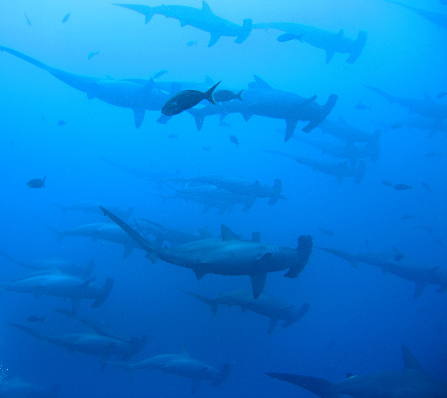
When Dr. Peter Klimley, AKA Dr. Hammerhead, was studying the scalloped hammerheads of El Bajo seamount near La Paz in the late 1970s, he attached little compass sensors to some of the sharks and made an amazing discovery. “The sharks were swimming like we would drive a car down the highway, directly from one point to another.”
The sharks would leave El Bajo seamount, go out for 10 miles or more in the middle of the night, and return in the morning with no problem at all. How could they do that? Two things. Firstly, the Gulf of California is filled with magnetic fields of lava flows around seamounts, and the sharks use the magnetic fields to navigate, like following neon signs along the highway. Secondly, the whacky shape of the hammerhead’s head means that the shark’s sensors, known as ampullae of Lorenzini, are spaced widely apart over a larger surface so the sharks can better detect variations in the magnetic field, reading the lava flows as clearly as a white line down the highway.
The result, demonstrated by Klimley and published by National Geographic, is that hammerheads are using seamounts alike El Bajo as hook-up joints along established migration routes. Interestingly, the vast majority of the sharks gathering at the seamounts are female, and Klimley found that they are fighting each other to establish dominance as the males prefer to mate with the strongest females. 400 million years of evolution at your service ma’am!
One of the Jesuits’ prime motivations in establishing themselves in Baja California in 1697 was to pursue their dream of a theocracy, a society completely devoted to God, with all productive activity in the service of the missions as they worked to convert the native peoples. While there was some grumbling about the Jesuit lock on the economy, for the first 50 years of Jesuit rule no one came along with the entrepreneurial drive, financial backing, or political support to challenge it. But then the heavens opened and the Jesuit sands shifted. As recorded by missionary Miguel del Barco:
Because of an unusual storm…the sea cast up a great multitude of pearl oysters, mounding them on certain beaches from the 28th parallel on to the north. This area, to that time, had not been worked by pearl hunters. The Indians of that coast, recent Christians, knowing that soldiers desired and bought pearls, began to bring them in abundance to the men of the escort at Misión de San Ignacio, then the heathen frontier.
Manuel de Ocio. Photo courtesy of Museo Ruta de Plata
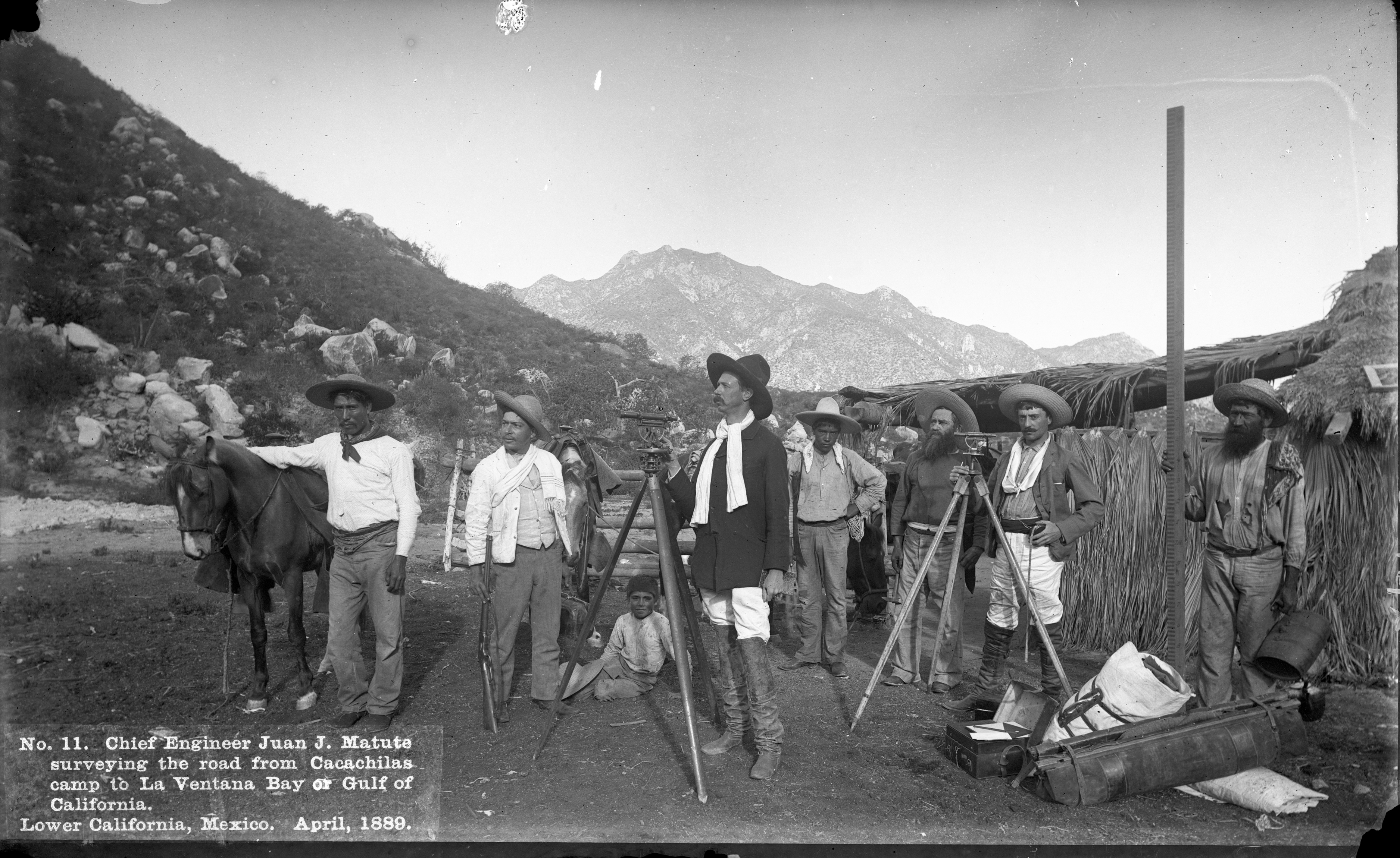
And so it happened that an act of God brought riches to the Jesuits’ earthly defenders and thereby created the first direct threat to their Baja California theocracy. The soldier who wrangled the majority of the profits from the great pearl bonanza was Manuel de Ocio, the Spanish son-in-law of the captain, who capitalized on his connections to broker the pearls and make the beginning of his fortune. In short order he resigned as a soldier, invested in pearling equipment and bought goods to trade with the Indians who were still collecting the pearls. Baja California’s first entrepreneur was launched, and he soon found he was not the only one eager to break the Jesuit monopoly. In 1743 the pearl-rich de Ocio went to Guadalajara where he found businessmen keen to push for a civil colony in Jesuit territory, and by 1748 he had laid claim to Santa Ana, site of an abandoned Jesuit chapel where a Spanish soldier had spotted silver ore in 1722. de Ocio created his home and cattle ranch there, and began mining silver near present day San Antonio. Real Santa Ana was the first secular settlement in Baja California, and San Antonio today is considered the oldest continuously settled town in the peninsula. The Jesuits were expelled from Baja California in 1767, but a thriving secular economy launched by de Ocio and built around mining continued for another 150 years.
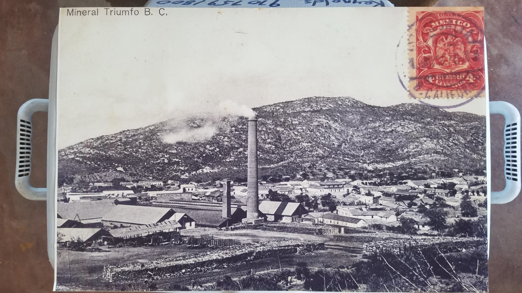
Stories like de Ocio’s are the highlight and backbone of the Museo Ruta de Plata, the Silver Route Museum, which opened in the Baja Sur town of El Triunfo November 17, 2018. The brainchild of Christy Walton, Richard Kiy, John Reynolds, and Juan Jose Cabuto, the museum reflects the remarkable research the team conducted to resurrect and celebrate the mining heritage and societal changes wrought by de Ocio and others who came to the area to pursue their dreams. Troves of documents were recovered in the public archives of La Paz, descendants of key players in the town’s mining industry were tracked down and interviewed, and oral histories were gathered from families in the area who are direct descendants of the Mexican, French, German, Polish, Chinese, American, and English miners, entrepreneurs, teachers, tradesmen, artists, shop owners and others who created what was once the largest town in the Baja peninsula with one of its most diverse and fascinating communities.
Museo de Ruta Plata is part of a much larger project by Christy Walton, heir to a portion of the Walmart fortune, to create in the greater La Paz region of Baja Sur “a thriving economy and engaged social system that respects and nurtures our unique environment.” Her Baja-based Alumbra companies include: Rancho Cacachilas, a land management organization that engages in livestock management, gardening, honey and cheese production and ecotourism activities; Earth Ocean Farms, an offshore marine fish farming company; Sol Azul which engages in year-round oyster production, and Tenaja Holdings, a real estate development company that manages the silver museum. The integration of all these projects is readily found in the silver museum complex which includes Restaurant-Bar El Minero, a wonderful culinary destination built on the ruins of an old cantina, where on any given day you can enjoy traditionally-made cheese from Rancho Cacachilas, organic oysters from Sol Azul, and farm-bred totoaba (critically endangered in the wild) from Earth Ocean Farms. The museum itself was built on the site of some abandoned buildings that they believe once housed a tannery, all right next to the ruins of the silver mining and milling operations. In fact, it was when Walton saw some children playing in these ruins that she was inspired to create the museum as a way to help revitalize El Triunfo by promoting its cultural heritage, one that was perhaps already lost to its younger generations.
El Triunfo in its heyday. Photo courtesy of Museo Ruta de Plata
de Ocio started a major mining boom in the area and from 1862 to 1926 the network of gold and silver mining operations completely transformed the area, making El Triunfo and San Antonio the wealthiest towns in Baja California in the process. El Triunfo had been a sleepy little village of 175 souls in 1857, but by 1890 had grown to a vibrant hub of over 4,000 as people flocked to the area to make their fortunes. Money flowed and the residents invested in the good life; a huge number of pianos were imported from Europe, and classical music concerts and artistic performances were a regular feature of town life. Gourmands imported apples from San Francisco and the cantinas imported American beer from St. Louis and Milwaukee. It was even rumored that Gustav Eiffel, he of the Paris tower, designed the still-standing La Ramona smokestack in 1890 for the Progreso Mining Company. While the museum states there is no evidence that Eiffel designed the tower, for Eiffel fans it should be noted that there is no evidence that he didn’t either.
Photo Courtesy of Museo Ruta de Plata
1890 was an important year for El Triunfo on another front as well. The United States enacted a federal law called the Sherman Silver Purchase Act, which effectively made the US government the second-largest buyer of silver in the world, second only to the British Crown in India. Under the terms of the act the government was required to purchase an additional 4.5 million ounces of silver bullion every month, in addition to the US$2 to $4 million required previously. Silver mining around El Triunfo surged. But the Sherman Silver Purchase Act, initially conceived of as a way to boost the economy and create sufficient inflation to allow farmers and miners to pay off debts that had become untenable due to deflation, was unsustainable. It contributed to a major economic depression in the US, and in 1893 was repealed. The US moved to the gold standard and the price of silver plummeted.
It was the beginning of the end for the mining towns of BCS. The mines struggled and the Mexican Revolution of 1910-1917 exacerbated their challenges. Ultimately, the silver boom ended as it began, with a monumental storm. This time however, instead of riches being tossed upon the shore, the hurricane of 1918 washed them away, destroying much of the town and rushing arsenic from shattered mines downstream, devastating local livestock along the way. 25 human deaths were recorded, and all ships in La Paz were reportedly damaged, sunk or run aground. The last mine in El Triunfo closed in 1926, and the town shrank back down to the sleepy little town of a few hundred folks that it is today.
Today Mexico is the largest producer of silver in the world, producing 5,600 metric tons in 2017. But no one in El Triunfo seems to be clamoring for a return to the old mining days. Turns out the quality of the silver in the area wasn’t that great anyway. A 1906 US Consular report on display in the museum notes that the ore of the area “is not high grade and is very rebellious.” But the high price of gold in the global market today has created persistent efforts from companies outside of BCS to establish open pit gold mining in the area once again. For its part, Museo Ruta de Plata makes it clear that although mining for minerals drove the settlement of the area, mining for knowledge is the long-term economic path forward for the region. Exhibits in the silver museum laud the extraordinary biodiversity and natural beauty of the area, alongside the scientific research and distinct ecotourism opportunities they represent. As with places like the Galapagos that have a similarly unique and biologically diverse environment, jobs based in sustainable tourism, conservation and research seem to be the hope for the resurgence of El Triunfo and the surrounding towns of BCS. Even the Jesuits would have been happy about that economic plan.
Sources for this article include: Harry W. Crosby, Antigua California: Mission and Colony on the Peninsular Frontier, 1697-1768; Juan Jose Cabuto of Museo Ruta de Plata; and the displays and websites of Museo Ruta de Plata. www.museorutadeplata.com.
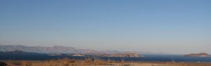
These days when you visit the Baja peninsula and the Gulf of California things can seem slow, lazy, sometimes as if not even time is moving. It is the moment, it is Zen, it is calm. This is not how things started. Baja and the Gulf of California were born from crashing tectonic plates, erupting volcanoes and the violence of geology. They were created quickly, in the blink of an eye, and not very long ago. Geologically speaking.
Dr. Scott Bennett of the US Geological Survey has studied the geology and tectonics of Baja California for years and published numerous scientific research articles on the formation of the peninsula and the Gulf of California. He lays out the process of their short, intense creation, and where you can identify pieces of the birth story on your travels throughout Baja. “100 to 80 million years ago (Cretaceous period), a subduction zone existed along the western edge of North America, including Mexico. The Farallon and North American plates were moving towards each other, with the Farallon plate subducting underneath the North American plate, heading down to the east. This subduction motion (writer’s note: some might modify “motion” with adjectives like smashing, hurdling, crashing) formed ancient volcanoes at Earth’s surface, and large batholiths of granite in the magma chambers below. Then 50 to 40 million years ago, the angle of the down-going Farallon plate seemingly shallowed, causing mountains, such as the Rockies in the USA and the Sierra Madre Oriental in Mexico, to shoot up throughout Western North America. This uplift, and the related erosion (which erased the previously formed volcanoes) brought the older granite rocks to the surface. These are the rocks that you see today stretching for miles as you travel through the Valley of the Cirios (Valle de los Cirios) in the mid-section of the peninsula, on Highway 2 between Tijuana and Mexicali, and in the Sierra La Laguna mountains between Todos Santos and San Jose del Cabo.”
Now it may seem to our human mindset that this all took place an exceedingly long time ago. But to understand just how young the Baja peninsula really is, consider that those who know how to calculate such things say that Earth is 4.54 billion years old, give or take 50 million years. That is to say, most of the action that formed the land of the Baja peninsula took place in the period of time that correlates to a margin of error for the formation of Earth. And we’ve only gotten to the granite and the mountains. What is now the Baja peninsula was still firmly attached to mainland Mexico, and the Gulf of California was not even a twinkle in the Pacific Ocean’s eye.
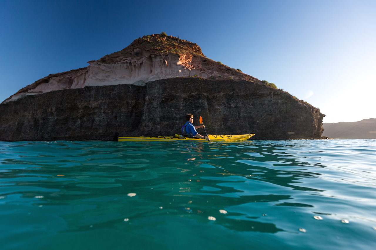
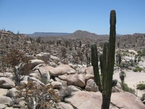
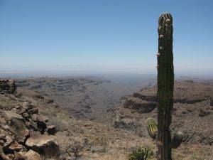
“Then 25 to 12 million years ago (Miocene period), the Farallon Plate in the Pacific Ocean started subducting east at a much steeper angle again, like a curtain whipping downwards” says Scott. “This steepening angle created more volcanoes, but their location shifted back to the west, tracking with the ever-steepening, subducting Farallon plate. The volcanic rocks from this period make up a lot of the flat top mesas that you see in Baja California today in areas like Cataviña and La Purisima, as well as the massive piles of volcanic rock in the high peaks of Sierra Madre Occidental in Sonora, Sinaloa and Nayarit. The Tres Virgenes Volcanoes, in the midsection of the Baja peninsula, were formed at the end of this period. Isla Espiritu Santo, off the coast of La Paz in the Gulf of California, gets its striking beauty from the wonderfully layered volcanic rock, mostly tuff (rocks made of compressed volcanic ash), that has been gently tilted along normal faults. Brian Hausback, a geology professor at California State University, Sacramento, has dated some of the volcanic rocks of Isla Espiritu Santo to 16-21 million years old, making them older than the formation of the Gulf of California seaway.”
Which means that, at this point in our story, the Baja peninsula is still stubbornly connected to the mainland. But we’re getting to the good part now!
“Then, 12 million years ago, the conveyor belt of subduction stopped” say Scott. Plates stopped colliding and the volcanoes slowly waned. There was calm. But then, thanks to a complex reorganization of tectonic plate motions, a new phenomenon emerged: oblique rifting. The plates began pulling apart, but at an oblique angle. Scott continues. “This oblique rift is called the Gulf of California Shear Zone. It became connected with the southern end of the San Andreas fault near the Salton Sea, which now made its way to Mexico. This resulted in right lateral fault motion in northwestern Mexico, and everything to the west of it began ripping away from the mainland, moving to the northwest, including the sliver of California that is to the west of the San Andreas fault – San Diego, Los Angeles, Big Sur, Santa Cruz. The area that is now San Jose del Cabo wrenched away from the area that is now Puerta Vallarta, and the formation of the Baja peninsula was in motion.” At last!
The rest of it didn’t take long. By 8 million years ago the rate of ripping (oblique rifting) increased and the Gulf of California seaway (finally!) started to form, with the waters of the Pacific Ocean trickling up to somewhere around La Paz. By 7 million years ago the Gulf of California seaway had trickled up to Guayamas, and by 6.3 million years ago the gulf waters had gone all the way up to the Salton Sea region, forming an extremely long and skinny Gulf of California seaway from Cabo to southern California that was probably no more than 10 to 50 kilometers wide and well over 1,000 kilometers long.
Of course, no current map shows the Gulf of California connected to the Salton Sea, and for that we can thank the Colorado River. About 5.5 million years ago it started flowing into the low-lying areas at the northern end of the Gulf of California (which was rapidly rifting apart) and forming large tectonic valleys that are similar to Death Valley today. The Colorado brought with it an enormous amount of sand and silt that essentially filled up the tectonic valleys across the entire area from the Salton Sea to the current Gulf of California, forming an agricultural river delta between Mexicali and Yuma. When you look at Google Map imagery of the Gulf of California today, you can clearly see the smooth, sandy bottom that characterizes the seafloor in the northern part of the gulf where the Colorado River deposited sand and silt, in contrast to the jagged and faulted continental remnants that characterize the seafloor in the central and southern Gulf, from about Bahia Los Angeles on down. The whole story is written right there on the seabed.
And the story is not over yet. The Gulf of California is still rifting apart, and the Baja peninsula continues its journey to the northwest, moving away from mainland Mexico at about 45 millimeters per year, although sometimes much faster. Observes Scott, “We are constantly reminded of the active tectonic plates in the Gulf of California by large earthquakes of Magnitudes 4 to 6 that occur in the Gulf every year. The most recent large earthquake (M7.2) occurred in northeastern Baja California on Easter Sunday 2010, tearing a 120-kilometer gash across Earth’s surface, and moving the Baja peninsula several feet towards the northwest in less than a minute.”
Baja’s journey will continue. Along with the southern parts of the US state of California that are to the west of the San Andreas fault, Baja will continue to travel roughly 50 kilometers every million years, eventually sliding past Vancouver and Juneau and colliding with Anchorage in 50 million years or so. Which, remember, is just the margin of error for the age of Earth. We are practically there.
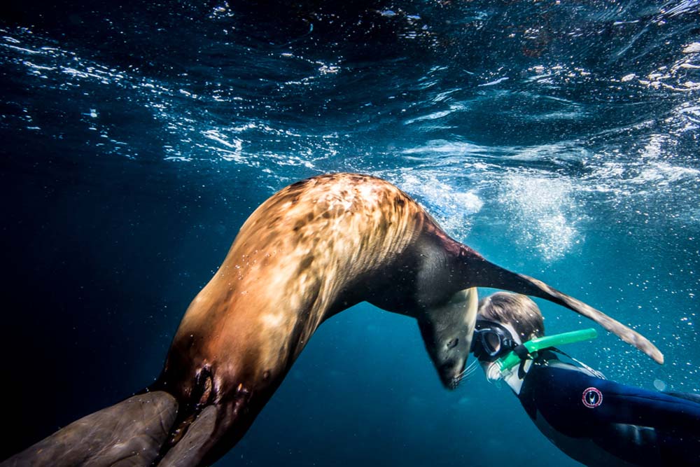
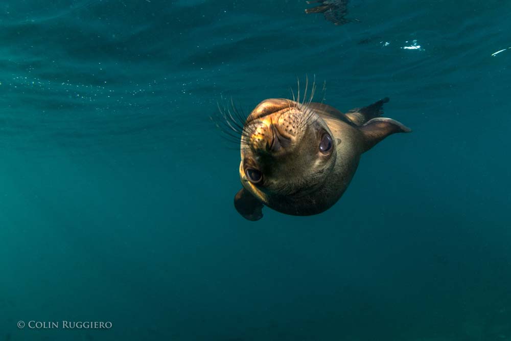
Swimming with the sea lion puppies at Los Islotes, the southernmost rookery of the California Sea Lion, Zalophus californianus, is truly one of life’s great joys. The puppies are often playful and naughty, nibbling on the flippers and fingers of human visitors, while their teenage siblings like to sidle up to humans for a good belly rub or game of chase. Their mothers may be found sunning themselves on the rocks, enjoying a snooze, while the males who rule the 20 territories of Los Islotes indefatigably patrol the waters to ensure everyone’s safety. It is a scene of utter Baja bliss, and humans can’t help but feel a magical glow from this most wondrous of wildlife encounters.
All of which begs the obvious question: Why are the males working so hard when everyone else is just having a good time?
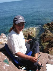
Claudia J. Hernandez-Camacho, a professor of biology at CICIMAR in La Paz, has been studying the sea lions of Los Islotes and the Sea of Cortez since 1990. In particular, she has studied the entire lifespan of 190 sea lion individuals (94 females, 96 males) who were hot-branded by her professor between 1980 and 1984. Her findings, based on these specific sea lions and others, tell a complicated tale for our pinniped friends.
“Sea lions are polygynous, meaning that one male mates with several females in the territory that he defends on land and sea. It takes an enormous amount of energy to defend this territory, and in the breeding season a territorial male, who is so focused on his job that he barely eats or sleeps, can lose up to 30% of his impressive body weight (400 to 500 kilos, or about a ton) in just a few weeks.”
Photo by Colin Ruggiero for Todos Santos Eco Adventures
One would assume, of course, that the males are spending this incredible amount of energy to defend their harems and offspring, to ensure the survival of their genes. “But this is not exactly the case” says Claudia, “they are defending the territory, not the females.” The science proves this out. “Genetic studies show that just 15% of territorial males are the fathers of the newborns the next breeding season. It is not just that the females hook up with and get impregnated by wandering, opportunistic males when they slip off for their 4-5 day feeding trips, which they do, but in some cases the territorial males are not even copulating with the females in their territory.” All that work and no sex?
“It’s a little more complicated than that,” says Claudia. “There are 600 individual sea lions at Los Islotes, and every year around 170 pups are born. Almost 30% of the pups die in the first two years, either from disease or because they or their mothers have fallen prey to predators. But that means that 70% are surviving. With this type of situation, many of the sea lions are, by definition, related. It could be argued that the Los Islotes males work so hard not just for their own offspring, but because they are protecting their extended families. This would also explain why they do not copulate with all the females in their territory. They are avoiding inbreeding.” This is an approach to collective living that we generally only associate with high intelligence mammals like primates, elephants and dolphins.
The Los Islotes territorial males are so successful in their defense of the colony, and have made conditions so conducive to survival, that Los Islotes is actually full to capacity now. In fact, two new satellite colonies have been created nearby in recent years by all the young males who are no longer welcome at Los Islotes, but who are still too young and slight to fight older, larger males for territory. Sea lions are philopatric, meaning that they stay in or habitually return to the area of their birth, so it is possible that these satellite colonies will only continue to grow.
What makes this all the more remarkable is that it is happening at a time when the overall population of California Sea Lions in the Sea of Cortez is dropping dramatically. Between 2000 and 2018, 40% of the population of other colonies disappeared. Are those males falling down on the job? Not likely says Claudia. “We are analyzing a lot of
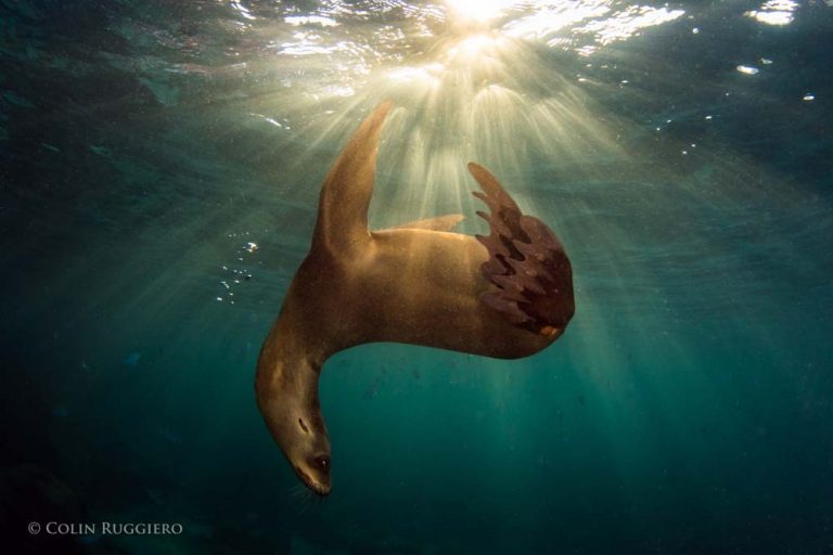
Photo by Colin Ruggiero for Todos Santos Eco Adventures
environmental variables right now to determine the main factor causing the decline of these colonies, but one of the most likely culprits is the food supply” she observes. “It is not that the fish populations in the other parts of the Sea of Cortez are declining, they are not. It is that the fish are moving further south. While the sea lions of Los Islotes, the southernmost California Sea Lion rookery, are benefitting from this trend, it is proving lethal to others. Healthy females will travel up to 60 kilometers away from their colonies to find food, but further than that is not feasible. They need to conserve energy to produce milk for their pups. And even in those more northern locations where there are still fish, there are a very limited number of fish species, and this relatively poor-quality diet means that the females are not gaining enough energy from their food to productively nurse their pups. On the opposite side of the coin, the sea lions of Los Islotes are getting an increasing number of fish species in their diet, with the result that population density has reached an all-time high.”
Female sea lions are not only philopatric, i.e., prone to stay in the area where they were born, they are attached to very specific real estate in that area, with many staking one specific rocky outcropping for their own. So with the increasing density of the population at Los Islotes, it is not surprising to learn that sea lion attitudes are becoming a bit more aggressive. Add to that the fact that the entire colony of females either a) goes into estrus, or b) has newborn pups to defend at exactly the same time and breeding season, which generally takes place June 1 to August 31, becomes a time when human body parts might best be kept at a distance from the sea lions of Los Islotes. In fact, Los Islotes is now closed to snorkelers and scuba divers during this period.
Los Islotes is regularly listed as one of the top diving/snorkeling spots in the world, and Claudia and her students are launching a study to evaluate the effects of all these visitors on the sea lions. The tourism hiatus being imposed by the authorities during breeding season offers them the perfect opportunity for their research. “We have already collected fecal samples from the sea lions during the tourist season, and will now do so again when the colony is closed to tourists. We will then test the level of cortisol, a stress indicator, in both sets of fecal matter to determine if tourism increases stress in sea lions. We have already observed some differences in behavior in the sea lions at Los Islotes. While at other, more remote colonies, the sea lions will copulate during the day, at Los Islotes they only engage in this behavior at night. We hope to be able to determine if tourism is having an impact on the sea lions.”
Claudia at Los Islotes
Of course, liking your loving in the evening time is a common enough attribute of many healthy mammals, but if other colonies are also enjoying some afternoon delight, have the sea lions of Los Islotes gone too far in adapting to the presence of humans? Will the territorial males one day snap back to impose a more natural environment for their territories? Human males have certainly done battle over lesser issues.
Tourists have been visiting Los Islotes on a regular basis for roughly three decades, and sea lion males live an average of 19 years. There is therefore not yet a deep institutional knowledge about humans among the territorial males, and they could still be giving us the opportunity to demonstrate our worthiness as visitors to their home. Will we make the cut? We can’t be sure what the sea lions have learned about humans over the years, or what Claudia and her team will demonstrate, but the strong pull of Los Islotes on humans is easy enough to understand: it is a place where joy and spontaneity rule, and we thrill to that vibrancy. While the territorial males are likely not motivated by their roles as life coaches for humans, it is enticing to think that maybe just one of the reasons they work so hard is to protect such a joyful lifestyle for their families. Claudia and her team are working hard to do the same.
VISIT WITH CLAUDIA AND HER TEAM!
Todos Santos Eco Adventures is the leading eco adventure company in Baja California Sur. On Isla Espiritu Santo we operate Camp Cecil, a luxury tent camp, and Camp Colossus, a moveable glamping operation. Claudia and her students will be spending time with us at our camps throughout the season as they conduct their sea lion research, so you may find them at the dinner table if you spend time with us at the island!


 “Then 25 to 12 million years ago (Miocene period), the Farallon Plate in the Pacific Ocean started subducting east at a much steeper angle again, like a curtain whipping downwards” says Scott. “This steepening angle created more volcanoes, but their location shifted back to the west, tracking with the ever-steepening, subducting Farallon plate. The volcanic rocks from this period make up a lot of the flat top mesas that you see in Baja California today in areas like Cataviña and La Purisima, as well as the massive piles of volcanic rock in the high peaks of Sierra Madre Occidental in Sonora, Sinaloa and Nayarit. The Tres Virgenes Volcanoes, in the midsection of the Baja peninsula, were formed at the end of this period. Isla Espiritu Santo, off the coast of La Paz in the Gulf of California, gets its striking beauty from the wonderfully layered volcanic rock, mostly tuff (rocks made of compressed volcanic ash), that has been gently tilted along normal faults. Brian Hausback, a geology professor at California State University, Sacramento, has dated some of the volcanic rocks of Isla Espiritu Santo to 16-21 million years old, making them older
  than the formation of the Gulf of California seaway.”